The advantage was that MapInfo maps are fully geocoded - i.e. they have real lat/long coordinates. For Nod, I began with a map of North America and then drew my continents (based on a projection of Earth many millions of years into the future) on top of it. From there, I slowly sculpted the shorelines, drew in woodlands, hills, mountains, deserts, etc.
Two full campaigns were run in the world, one set in Thule (then referred to as Og) and the other in Mu-Pan, and then I began the process of creating the hex crawl material for the gaming magazine. In the process, quite a few things changed - primarily in terms of the style of the world from Greyhawk-style nation state model to the "tiny-pockets-of-civilization-amidst-monster-infested-wilderness" model.
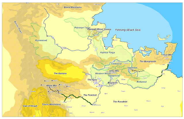
Anyhow - I was recently checking out those original maps, and thought folks might like to see them. They aren't precisely the same scale (and I'm too lazy to include the scales), but they should give you an idea of what this big lump of fantasy world grew out of.
(As usual, click to embiggen)
Mu-Pan
It originally had more cities, towns and villages. The desert in the north is Yondo. The Tsanjan Plateau is based on the idea of Leng.
Thule
Originally called Og after the big river in the south (a sort of Nordic Amazon). Home of the first Nod campaign, an epic murder-mystery that taught me that I had players with absolutely no interest in solving murder mysteries. Fun nonetheless. Probably the next area I'll cover with a hex crawl.
I'm considering cleaning these up (i.e. updating them) and using them in the NOD Companion.


I for one would love to see more nonhex maps of Nod. The hex maps are great and super useful, but maps like the two above have a certain feeling that hexes just can't capture. Your Virgin Woode map is another good example.
ReplyDeleteI like them as well, but they do gobble up the time.
DeleteThe Barrier Peaks?
ReplyDelete......I see what you did there. :)
Yeah, for the original "not-going-to-be-published" campaign, I was weaving just about every old D&D/AD&D module I had access to into the campaign world. Module A1 was set just outside of Ophir, part of the first hex crawl I published in NOD 1. At the time, I was just transferring from 3E to Castles & Crusades and using the Age of Worms adventure path deal from Paizo.
Delete